Mille Lacs Lake Depth Map & Structure
Few things are more frustrating for a Minnesota angler than staring out at the vast expanse of a huge lake like Mille Lacs, knowing there are fish somewhere, but having absolutely no idea where to start. It feels like finding a needle in a haystack, or worse, just drifting over "dead water." This guide is all about demystifying Mille Lacs Lake, diving deep into its critical depth map features and structural elements to help you pinpoint those elusive fish and make every minute on the water count.
Why Understanding Mille Lacs Depth Maps Matters So Much
Mille Lacs is not just a big lake; it’s the second-largest lake entirely within Minnesota, covering over 130,000 acres. That's a lot of water to cover, and without a solid understanding of its underwater topography, you're essentially just guessing. Relying solely on your intuition or hearsay from other anglers will only get you so far. A depth map acts as your underwater roadmap, revealing the hidden highways and neighborhoods where fish live, feed, and spawn. It transforms a daunting, endless blue into a structured, understandable environment, guiding your approach and drastically increasing your chances of success.
The Frustration of "Dead Water"
Imagine spending hours trolling or casting, feeling hopeful with every retrieve, only to come up empty-handed. That soul-crushing feeling of hitting "dead water" is a common experience for those who don't leverage the power of a good depth map. Without knowing the subtle breaks, the rock piles, or the deep edges where fish congregate, you're essentially fishing randomly. It's like trying to find a specific house in a huge city without an address or a map – utterly inefficient and incredibly disheartening. Many anglers return from a day on Mille Lacs wondering what they did wrong, when often, the problem wasn't their technique, but rather where they were applying it. Identifying these high-percentage areas beforehand allows you to focus your efforts, saving time, fuel, and most importantly, your sanity.
Unlocking Seasonal Fish Movements
Fish in Mille Lacs, much like anywhere else, are creatures of habit, but their habits change with the seasons. Water temperature, oxygen levels, available forage, and spawning urges dictate where they'll be. A depth map helps you predict and adapt to these shifts. For instance, in early spring after the ice melts, walleye might be shallow, staging for the spawn on sand flats or rocky points. As summer progresses, they'll often move to deeper, cooler water, relating to offshore reefs or mud flats. When fall arrives and the water cools, they might move back to shallower breaks to ambush baitfish. Understanding how fish use different structures at various times of the year is key, and a detailed map provides the crucial context. It’s not just about knowing where fish are, but why they are there at a specific time, allowing you to anticipate their movements. This seasonal pattern understanding is critical for any serious angler, and it's all laid out on a good depth map.
Decoding Mille Lacs Lake's Unique Structure
Mille Lacs isn't just a big bowl; it boasts an incredibly diverse and often complex underwater structure that makes it one of Minnesota's premier fishing destinations. From vast, sprawling mud flats to jagged rock reefs and dramatic depth changes, the lake offers a smorgasbord of habitats for different fish species. Knowing these distinct structural types and how fish interact with them is paramount to developing effective fishing strategies. It's this intricate subsurface landscape that holds the key to consistently finding fish.
The Iconic Mud Flats and Rock Reefs
When people talk about Mille Lacs fishing, the first things that usually come up are its famous mud flats and rock reefs. These aren't just buzzwords; they are the literal backbone of the lake's ecosystem and primary targets for anglers, especially those chasing walleye and smallmouth bass.
The mud flats of Mille Lacs are extensive, relatively flat areas of soft bottom, often ranging from 20 to 35 feet deep. What makes them so special are the subtle rises, depressions, and scattered gravel or rock patches that occur within them. These slight changes in depth or bottom composition act as magnets for baitfish, particularly tullibee (cisco), which in turn attract large schools of walleye. Fishing the Mille Lacs Mud Flats for Walleye is a technique almost unique to this lake. Anglers often troll spinner rigs or leadcore with crankbaits across these areas, or drift with Lindy rigs. The edges where the mud meets harder bottom, or where the flats drop off into deeper basins, are always prime locations.
Rock reefs and humps, on the other hand, provide hard structure, ambush points, and spawning grounds. These vary wildly in size, from small, isolated rock piles to massive, sprawling reefs that rise sharply from the lakebed. They can be found in shallow water, perfect for casting topwater for bass, or in deeper water, holding walleye and even pike. Some reefs, like the famous "Seven Mile Reef" or "Spirit Island Reef," are well-known hotspots. These structures offer cover, forage, and ideal current breaks, making them irresistible to various species. Anglers often target these with jigging presentations, live bait, or by casting crankbaits or jerkbaits. For those looking for a diverse fishing experience, Mille Lacs' varied rock structures offer endless possibilities.
Transition Zones and Deep Water Access
Beyond the main flats and reefs, the subtle yet crucial transition zones are often overlooked gems. These are areas where one type of bottom transitions into another—say, sand to gravel, or mud to rock. Fish, particularly walleye and smallmouth, frequently use these seams as travel corridors or feeding lanes, moving between different habitats depending on light conditions, pressure, and forage availability. A depth map will show these changes in contour lines and bottom composition, highlighting prime areas where baitfish might congregate or where predators might lie in wait. Look for points extending from shore, saddles between islands, or even areas where a shallow flat suddenly drops into a deep basin. These often create natural funnels for fish movement.
Deep water access refers to how easily fish can move from shallow feeding grounds to deeper, safer resting areas. Lakes with good deep water access right near prime structure tend to hold fish more consistently throughout the day, especially during bright sun or high boat traffic. On Mille Lacs, this might mean a rock reef that has a quick, steep drop-off into 40-50 feet of water, or a mud flat that borders a vast, deep basin. Fish can quickly move up to feed on the structure and then retreat to the cooler, darker depths when conditions change. Understanding these relationships on your map allows you to predict where fish might be throughout different parts of the day and adapt your tactics, whether you're jigging for walleye from a boat or exploring Summer Walleye Patterns: Deep Structure.
How to Use a Depth Map Effectively on Mille Lacs
Alright, you’ve got the map, you know what the various structures are, but how do you actually use it to put fish in the boat on a lake as sprawling as Mille Lacs? It's more than just glancing at a pretty picture; it's about strategic interpretation and integration with your on-board electronics. Think of your depth map as the blueprint, and your fish finder as the real-time sensor confirming what that blueprint is telling you. Used together, they become an incredibly powerful tool for unlocking the lake's secrets.
Digital vs. Paper Maps
The world of fishing maps has come a long way. Gone are the days when a folded, sometimes water-stained paper map was your only option. While paper maps still have a certain old-school charm and can be great for a quick overview or backup, digital maps have truly revolutionized how we navigate and fish.
Paper Maps:
- Pros: No batteries needed, durable (if laminated), good for big-picture planning, easy to mark up with a pencil.
- Cons: Less detail, can be cumbersome on the water, no real-time GPS integration, difficult to mark waypoints precisely. They’re a good starting point for general lake understanding, but they won't cut it for precision fishing on a lake like Mille Lacs.
Digital Maps:
- Pros: Unparalleled detail, real-time GPS positioning (showing your boat precisely on the map), ability to mark waypoints and routes, customizable depth shading, often include high-definition contour lines and satellite imagery overlays. Brands like LakeMaster (Humminbird) and Navionics (Garmin, Lowrance, Raymarine, etc.) are industry leaders, offering exceptional detail for Mille Lacs. Many apps also exist, like Fishbrain, that integrate mapping with community fishing reports.
- Cons: Requires power, learning curve for advanced features, can be expensive, screen glare can be an issue.
For serious Mille Lacs anglers, a good digital map on a reliable fish finder or a dedicated GPS unit is almost a necessity. The ability to zoom in on a small hump on a vast mud flat, mark a waypoint, and navigate directly to it is invaluable.
Interpreting Contour Lines and Shaded Relief
Understanding what those lines and colors on your map mean is the core skill of map reading.
Contour Lines: These lines connect points of equal depth.
- Close together: Indicate a steep drop-off or a sharp rise in structure (e.g., a breakline, the edge of a reef). These are often prime areas where fish transition or ambush prey.
- Far apart: Indicate a gradual slope or a flat bottom. While sometimes less exciting, subtle changes on a vast flat can still be fish magnets.
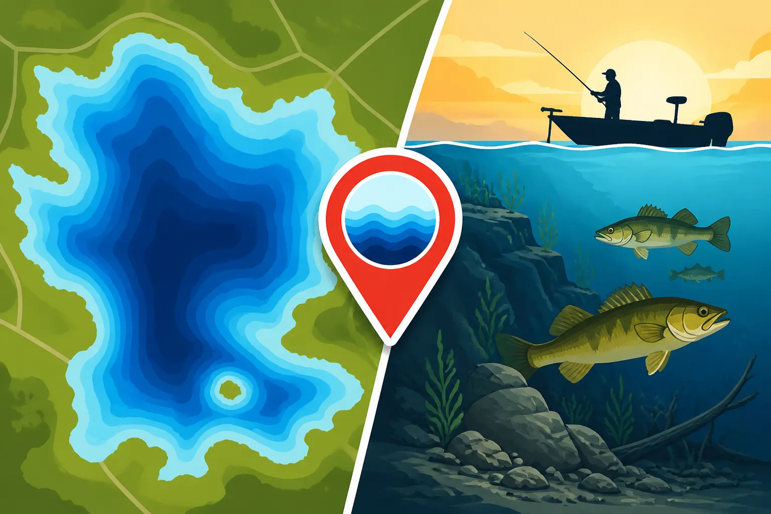
- Circles/Ovals: Represent humps (if deeper lines are outside shallower ones) or holes (if shallower lines are outside deeper ones). Humps are classic walleye spots on Mille Lacs.
Shaded Relief/Depth Shading: Many modern digital maps use different colors to represent depth ranges. For example, shallow water might be light blue, gradually darkening to deep blue for profound depths. Some maps even have customizable depth highlighting, allowing you to color-code specific depth ranges (e.g., highlight 15-20 feet in red) that you know are productive for walleye in Early Season Walleye After the Opener. This visual aid makes it much easier to quickly identify target zones. Look for distinct color changes, as these often coincide with the edges of structures where fish will congregate.
Integrating with Your Fish Finder
Your depth map tells you where to go, and your fish finder tells you what's there. These two tools work in tandem.
- Pre-trip Planning: Before you even leave the dock, use your digital map to identify potential hotspots. Look for sharp breaks, prominent humps on mud flats, or the edges of large rock reefs. Mark these as waypoints.
- Navigation: Use your GPS and map to navigate precisely to your marked waypoints. No more guessing if you're on the right spot.
- Real-time Confirmation: Once you're on a promising structure indicated by your map, switch your fish finder (sonar) to a detailed view. Watch for fish arches, baitfish schools, and bottom transitions that confirm what the map suggested. A good unit like a Humminbird HELIX or Garmin ECHOMAP will show you exactly what's below. If your map shows a rock pile, your sonar should confirm rocks on the bottom. If it shows a break, your sonar should illustrate the change in depth.
- Fine-tuning: Use your fish finder's down imaging or side imaging (if equipped) to scan around your boat. This allows you to locate smaller, unmarked pieces of structure that might not be detailed on your map, such as isolated boulders or small baitfish schools holding tight to a subtle contour. This combination of the broad overview from the map and the precise detail from the sonar allows you to fish with surgical precision. When fishing with techniques like Jigging for Walleye: Jig & Minnow Basics, this precision is absolutely vital.
Key Mille Lacs Structural Hotspots to Target
Mille Lacs Lake has earned its reputation as a fishing powerhouse due to its expansive and diverse underwater topography. While every angler has their secret spots, certain structural elements consistently produce fish, season after season. Knowing these general areas and understanding why they are productive is the first step to unlocking consistent success on this magnificent lake. Remember, fish move, but the structure remains, always a potential holding area.
Famous Walleye Factories
Walleye are the undisputed kings of Mille Lacs, and the lake offers a variety of "factories" where these delicious fish congregate.
- The Mud Flats: As mentioned, the vast mud flats are quintessential walleye territory, especially in summer and fall. Look for the subtle changes in depth – humps, rises, and hard-bottom patches within the soft bottom. These are baitfish magnets, and where the bait goes, the walleye follow. Key areas include the "Million Dollar Flat" or "Twin Pines Mud Flat," known for their expansive fishing grounds. Tactics like slow-trolling spinner rigs with leeches or crawlers, or pulling crankbaits on leadcore, are deadly here. When the sun is high, walleye often hug the bottom, making a Bottom Bouncer & Crawler Harness for Walleye an excellent choice.
- Offshore Rock Reefs: Mille Lacs is dotted with numerous offshore reefs that rise sharply from the depths. These provide perfect ambush points and often hold concentrations of baitfish and crayfish. The "Garrison Reefs" on the west side, or "Spirit Island Reef" near the center, are legendary. Walleye will often stage on the deeper edges of these reefs during the day, moving shallower to feed during low light. Vertical jigging with a minnow or a jigging rap is highly effective, as is slowly dragging a live bait rig. Always pay attention to the wind, as a good walleye chop often makes these reefs even more productive. Don't forget to check the specific Mille Lacs Walleye Regulations (2026) before heading out, as limits can vary.
- The Transition Edges: Don't overlook the breaklines where hard bottom transitions to soft, or where shallow water quickly drops into deeper troughs. These are highways and feeding zones. A good example is the drop-off along the eastern shore, which can be fantastic, especially during cooler water periods. The key is to find those distinct edges on your map and fish along them. For more specific guidance, check out the Mille Lacs Lake Fishing Guide: Walleye, Bass & More.
Bass Bunkers and Pike Havens
While walleye steal the spotlight, Mille Lacs boasts an incredible fishery for other species, particularly smallmouth bass and northern pike, often found relating to specific structures.
- Smallmouth Bass: Mille Lacs is widely considered a world-class smallmouth bass fishery. These bronze bombers absolutely love rock. Focus your efforts on the countless rocky points, boulder fields, and main lake reefs that rise from moderate depths. Areas like the "Stony Point Reef" or the expansive rock fields near "Isle" on the east side are prime smallmouth real estate. Look for areas with a mix of different rock sizes and some aquatic vegetation. Tactics include casting tube jigs, Ned rigs, drop-shots, or crankbaits. Topwater lures can be incredibly exciting during low light or calm conditions. For an in-depth look at chasing these beauties, explore Mille Lacs Smallmouth Bass: World-Class Fishery.
- Northern Pike: While not as heavily targeted as walleye or bass, Mille Lacs offers fantastic northern pike fishing, especially for those looking for trophy-sized fish. Pike are ambush predators and will often relate to the edges of weed beds, submerged vegetation, and rocky points where baitfish concentrate. The shallow, weedy bays, especially early in the season, can hold impressive numbers. Look for extensive shallow flats with scattered weeds on your map. Casting large spoons, spinnerbaits, or jerkbaits over and around these areas is effective. Don't be surprised to encounter a big pike while walleye fishing on the reefs, as they often share the same structure. They love to patrol the edges where a mud flat meets a rock structure, or where a shallow shelf quickly drops into deeper water.
Understanding these structural preferences for each species, combined with precise navigation using your depth map, will significantly elevate your fishing game on Mille Lacs.
| Structure Type | Typical Depth Range | Target Species | Preferred Seasons | Key Features to Look For |
|---|---|---|---|---|
| Mud Flats | 20-35 feet | Walleye, Perch | Summer, Fall | Subtle humps, depressions, hard-bottom patches, baitfish schools |
| Offshore Reefs | 10-30 feet (tops) | Walleye, Smallmouth Bass, Pike | All | Sharp breaks, large boulders, nearby deep water access |
| Shallow Rocks/Points | 5-15 feet | Smallmouth Bass, Pike, Walleye | Spring, Summer (low light) | Boulder fields, transition to weeds, current breaks |
| Deep Basins/Breaks | 35-50+ feet | Walleye, Tullibee | Summer (mid-day), Winter | Sharp drop-offs from flats, oxygenated water, baitfish schools |
| Weed Lines | 8-20 feet | Pike, Largemouth Bass, Perch | Summer, Early Fall | Distinct edges of vegetation, pockets, open water access |
When planning your trip, consider booking a guide through a service like FishingBooker. Many local Mille Lacs guides are experts at interpreting these maps and can put you right on the fish. They know the current patterns and can teach you invaluable skills for future trips. For instance, if you're thinking about Trolling for Walleye: Crankbaits & Leadcore, a guide can show you exactly how to follow contour lines on a map to keep your baits in the strike zone. Or, if you want to master How to Catch Smallmouth Bass on Mille Lacs, they can help you identify the best rock formations.
Remember, every day on the water is a learning experience. Use your depth map not just as a tool to find fish, but as a guide to understand the dynamic environment of Mille Lacs Lake. The more you study and apply this knowledge, the more successful and enjoyable your fishing adventures will become.
Disclaimer
Fishing regulations, seasons, and limits for Mille Lacs Lake can change frequently. Always consult the latest Minnesota Department of Natural Resources (DNR) regulations before heading out on the water. This guide is for informational purposes only and does not supersede official DNR guidelines.